Beaches & Islands
Mayo remains unique as one of Europe's most unspoiled destinations in environmental terms. Clean coastal and inland waters, Blue Flag beaches, flora and fauna and the splendour of superb natural scenery are treasures which must be protected. Mayo County Council has prime responsibility for protecting the environment in consultation with other state bodies, local community and interest groups.
Blueway
You’ve tried the Greenway, why not try a Blueway?
Blueways are coastal sites that offer water activities such as snorkeling and sea kayaking, along a clear blue marine trail. Ten Blueway Taster Days have been organised over June, July and August. On these days, activity providers offer snorkeling and sea kayaking at a reduced cost. Outside of these dates, several activity providers offer equipment hire and instruction for water-based sports at these sites. Blueways are an exciting new tourism offering that support the Wild Atlantic Way initiative and give visitors the opportunity to explore our fabulous blue resource.
Where are the Blueways?
There are 5 Blueway sites as follows:
- Old Head, Louisburgh
- Keem Bay, Achill Island
- Killary Harbour (Glassillaun Beach)
- Mannin Bay (Clifden)
- Boffin Harbour (Inishbofin Island)
What is a Blueway Taster Day?
A Blueway Taster Day is an organised event, where you can sample Blueway trails at a reduced cost. Water activity providers are available on these days for instruction and equipment hire.
Are Blueways suitable for all ages?
Yes! Children aged 6 years and up can enjoy snorkeling but you must be over 14 years for sea kayaking.
Do you have to be able to swim?
Yes, you do have to be able to swim for all Blueway activities.
How do I find out more?
Check out www.blueway.ie
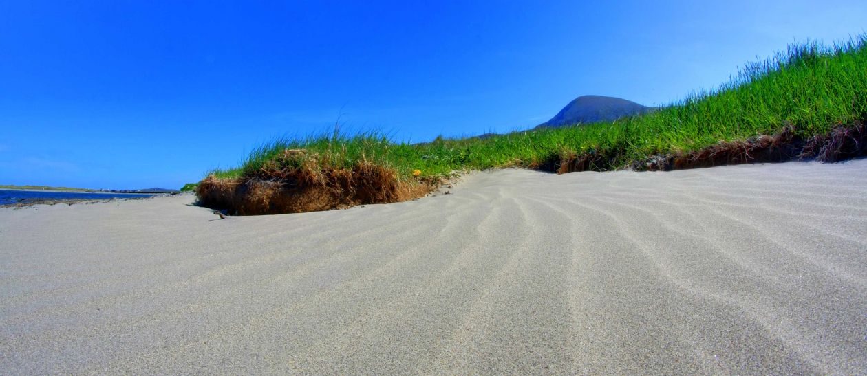
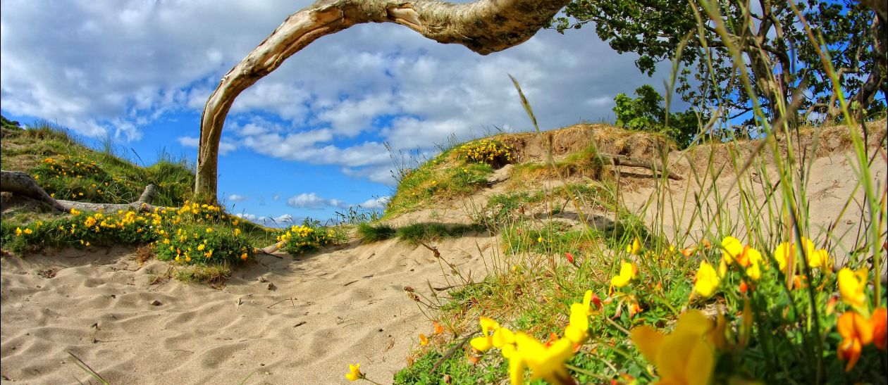
Beaches
There are few destinations in Europe to match the quality of Mayo's beaches and the County is the proud holder of no less than 12 Blue Flag awards. The beaches, recognised as being among the most outstanding in Europe, are each served with a comprehensive information panel, giving full details of amenities, flora and fauna. Blue Flag beaches meet 32 strict criteria for water quality, management, safety and environmental education.
12 Blue Flag Beach Locations:
- Killala: Ross Strand
- Louisburgh: Carramore Beach, Bertra Beach
- Achill: Keem Beach, Keel Beach, Dugort Beach, Golden Strand, Dooega Beach
- Belmullet: Mullaghroe Beach, Elly Bay Beach
- Clare Island
- Mulranny
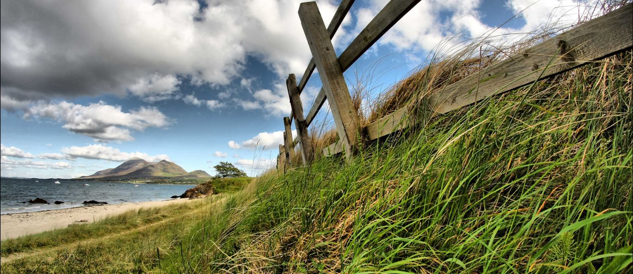
Bertra Blue Flag Beach
Near the foot of Croagh Patrick, 12 km (7 miles) west of Westport on the Louisburgh Road (R335), Bertra beach is one of the best beaches in Ireland for walking and bird-watching, as well as kite-surfing and windsurfing.
Walk along the wide strand, on a mixture of sandy or occasionally rocky stretches, or along the sometimes narrow paths in the dunes. This Blue Flag beach has a lifeguard in the summer months, and there are toilets. The northeastern point of the beach, farthest away from the carpark, is a popular spot for shore-angling.
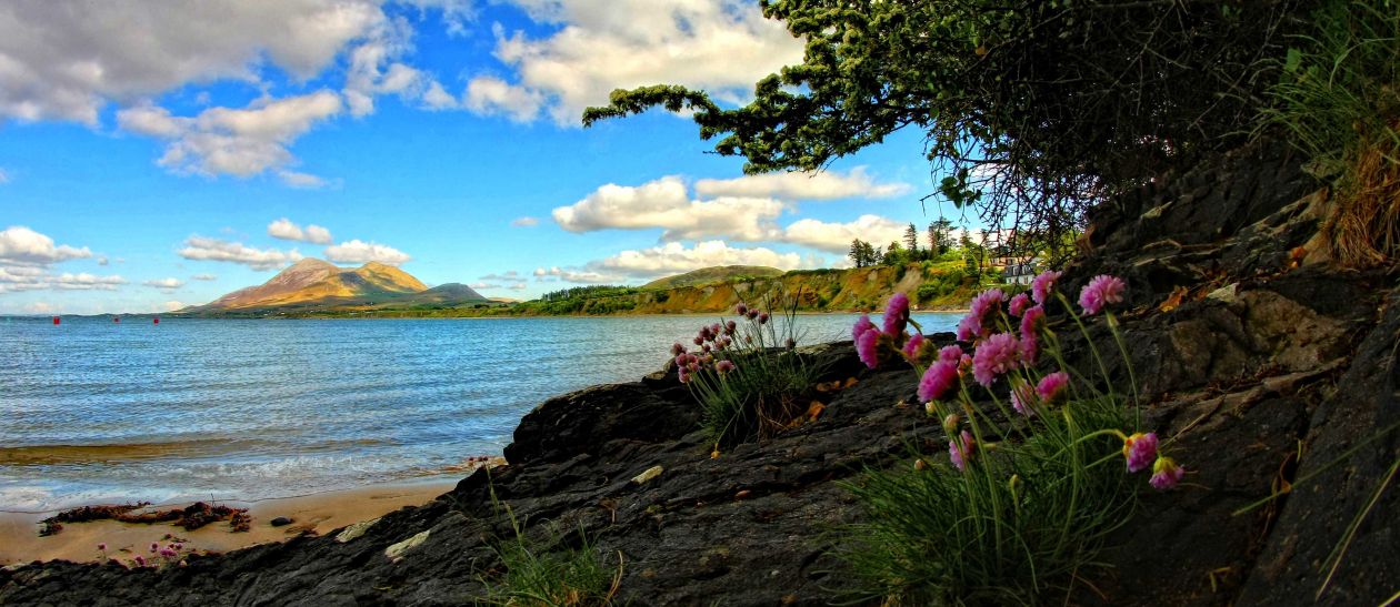
Old Head Beach
For a picturesque beach, Ireland offers very few to beat Old Head, 16 km (10 miles) west of Westport on the Louisburgh Road (R335). Overlooked by a woodland to the west and Croagh Patrick to the south and east, this beach has beautiful rock-pools that are exposed when the tide is out.
The beach is sheltered from the south and west and is therefore well-suited for swimming. Lifeguards are on duty through the summer months, the beach is accessible for wheelchairs, as are the toilets. There is a pier at the western end of the beach, sheltering a small anchorage popular with local sailors and fishermen.
Carrowmore Blue Flag Beach
1.5 km (under 1 mile) from Louisburgh, 25 km (16 miles) west of Westport, lies Carrowmore beach, overlooked by cliffs where various seabirds nest. There are lifeguards in the summer, as well as toilets, though there are no ramps or other facilities for disabled people. There is a pier at the west end of this Blue Flag beach, while the eastern border is the mouth of the Bunowen River.
Mulranny Blue Flag Beach
On the west end of Mulranny village, a causeway and wooden bridge across Trawoughter Bay lead to Mulranny beach, which has picnic facilities and toilets, as well as a lifeguard during the summer months.
Inland from the beach is a rare large saltwater marsh, with typical species such as thrift, sea plaintain, saltmarsh grass, rushes and sedges, sea pimpernel with glassword and annual seablite further down towards the sea. The marsh also features various shorebirds, including curlew, widgeon, grey plover, godwits, oyster-catchers, dunlins, sand pipers, terns and gulls.
There is also a small carpark at the beach. To reach the carpark, take the first left after the village and continue less than a half a kilometre to the entrance, following the signs.
Clare Island Blue Flag Beach
A short ferry ride from Roonagh Pier, 10 km from Louisburgh, leads to Clare Island, where the sandy blue flag beach lies adjacent to the pier. While there is no lifeguard, there is life-saving equipment available, so the beach is suitable for swimming.
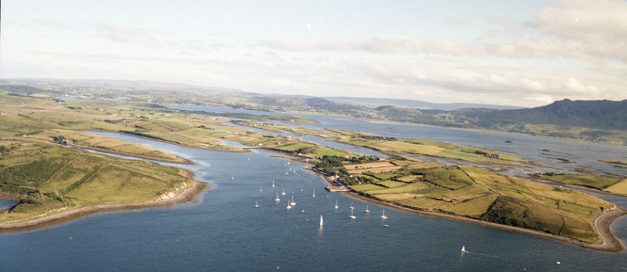
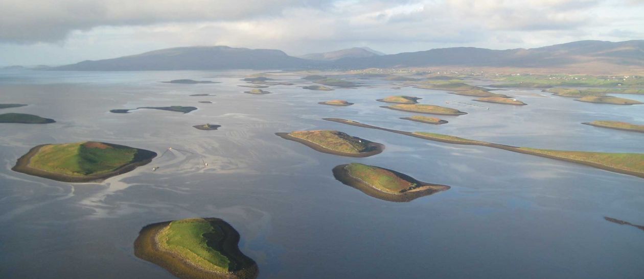
Islands
Achill Island
Achill Island is the largest island in the Country (24km x 19km) and is accessible from the mainland by bridge. Its magnificent sandy beaches, sea cliffs and warm hospitality bring visitors back again and again for holidays.
Visit the beautiful villages of Dooagh and Dooega, the high cliffs at Slievemore and Minaun, the magnificent beaches at Keel and Keem, under the Achill Head. The famous Atlantic Drive takes you on a journey of scenic splendour, a must for all visitors to Achill.
Clare Island
Situated at the entrance to Clew Bay, Clare Island is the largest of the Mayo offshore islands. Located off the West Coast, Clare Island is 3.5 miles from the mainland and is also the largest of the possible 365 islands in Clew Bay - it is 5 miles long and 3 miles wide.
With its varied landscape of spectacular cliffs and inland mountain terrain, Clare Island is an ideal destination near Westport for hill-walkers and nature lovers who will enjoy exploring large colonies of sea birds, alpine flora and neolithic and bronze-age archaeology.
Boasting a rich topography of hills, bogs and woodland on the inner parts of the island, it is an ideal holiday destination for hill-walking, cycling and sight-seeing. The island is full of amazing scenery and visitors can explore it on foot, by bike (bike hire nearby) or by taxi.
Inishturk
Inishturk is a small beautiful island, 5km x 2.5km, located 9 miles (14.5km) off the west coast of Mayo. It rises boldly from the wild North Atlantic in wall-like cliffs to the northwest and steep hills to the north on which stands the ruins of the old signal tower 688 ft above sea level.
Walking
The rugged island landscape will delight the walker. You can ramble around the island at your leisure and explore the many small country lanes that span the Island.
There are two recognised walks on the Island. The shorter one, the inner walk is a nice easy saunter, and a longer cliff walk through the commonage is more challenging.
Beaches
Young and old alike will relish the blue waters and fine sand of Tranaun and Curraun. These unspoilt beaches, protected by coves on Inishturk’s south-east coast, offer stunning views across to Mayo and the mountains of Connemara.
Community Club
When visiting Inishturk a trip to the Community Club is a must. The setting has been described as “The pub with the best view in Europe”.
You will enjoy the full island experience if you round your trip to Inishturk off with a pint of Guinness and an hour or two of ceoil agus craic in the community club.
Caher View Restaurant
Caher View Restaurant offers the most spectacular scenery in Ireland, with stunning views of Croagh Patrick and Mweelrea as you sample our menu.
For further information on visiting Inishturk please visit our website http://www.inishturkisland.com or call 0872102785